Park of the Canals
Prehistoric History
Approximately 300 B.C, Prehistoric Indians entered the Salt River Valley. They developed an extensive canal system and raised corn, beans, squash, agave and cotton.
Over 500 miles of Hohokam canals have been recorded in the Salt River Valley. Estimated suggest that the canals may have supported between 30,000 and 60,000 people with up to 100,000 acred under cultivation. Some of the Canals extended over 12 miles in length. For reasons still unknown, the Hohokam abandoned their canal system and left the valley by 1450 A.D.
In 1878, Mormom Pioneers constructed their first major canal by cleaning out an ancient Hohokam canal. The bridge to the playground spans another prehistoric canal. A third ancient canal is located just North of the playground.
The Park of the Canals preserves about 4,500 feet of ancient canals. The National Geographic Society has listed this park as an important site for Native American heritage. The American Society of Civil Engineers has awarded the Hohokam canal system an Award for Excellence in Prehistoric Engineering. This is the first time an ancient civil engineering project has been so honored. The Park of the Canals is listed as a National Historic site.
Additional information and a map of the park are located inside the Brinton Desert Botanical Garden.
The Mesa Canal
The Mormon Pioneers of 1877 settled along the Salt River in what is now Lehi. When the advance party, consisting of the four leaders of the Mesa group, arrived in January 1878, they were told that there was not enough land for them in the Lehi area. They would have to settle on the mesa, south of the Lehi Settlement.
The mesa consisted of thousands of acres of apparently fertile farm land that needed only water to make it productive. When the pioneers inspected the mesa they found the outlines of a prehistoric water channel. A new canal head had to be contructed to make the ancient canal system workable. Using only a straight edge and a spirit level, Francis Pomeroy, George Sirrine and Henry C. Rogers relocated their canal head less than two miles upstream from the head of the ancient canal. The new canal head was about three miles below the present location of the Granite Reef diversion dam.
Captain William Hancock the U.S Government surveyor, who serveyed the city of Phoenix, told the Mesa leaders that it was not possible to get water onto the Mesa by gravity flow. He reluctantly made a survey for them and found that the Indian canal, with the Mormon Pioneer extension would work if the canal head was moved an additional 100 feet up river from where Pomeroy and Sirrine had located it. The main Mesa company arrived February 14, 1878, and contruction on the canal began on February 17. The pay scale was $1.50 per day for a man and $3 per day for 1 man and a team. Total cost cost for labor was about $48,000. Slips and Fresno scrapers pulled by a team were used to clean out the Indian Canals.
By April 1878, water had been let into the first mile of the canal. It was used to irrigate the first crops which had been planted. In October 1878, the water began flowing up the bluff, seemingly in defiance of the Law of Gravity.
The water flowed through this canal to the diversion gates just South of the Park of the Canals. This is the only point on the mesa where water will flow in three directions.
The best preserved section of the ancient canal that was cleaned out and used by the Mesa Pioneers of 1878 is located about thirty yards Southwest of Park of the Canals.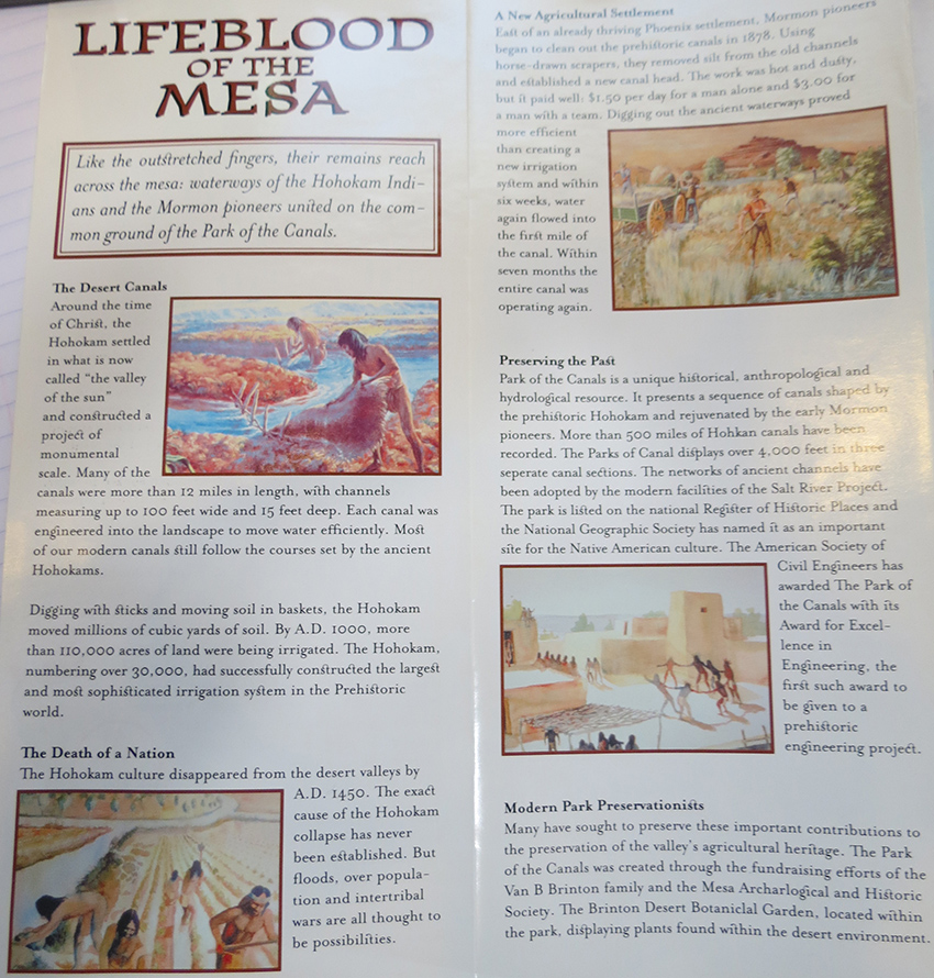